❄️Historic Snowstorm❄️ - Full Breakdown
- JDJweather
- Jan 25
- 3 min read
The arctic calm before the storm. A major and potentially historic snowstorm is on it's way very shortly for much of the Northeast. Temperatures right now are in the single digits for much of the area with snow working it's way northeast. After all is said and done much of the region, including Connecticut will be blanketed with over a foot of snow with up to two feet in some spots. Here are some key points:

Timing:
Snow begins shortly for central Connecticut and is just beginning for far western sections. Snow continues to march east/northeast during the morning and becomes heavy during the afternoon. The heaviest snowfall will occur during the afternoon into the evening. Snow or a mixture of snow & sleet tapers off just after midnight. Periods of flurries and light snow will likely continue into Monday with additional light accumulation possible.

Snowfall Rates:
Initially snow will come down lightly and pick up in intensity throughout the morning. The heaviest snowfall should occur from the afternoon to late evening. A changeover to sleet along the shoreline will limit accumulations there but this won't occur until at least 8" has fallen everywhere. After the main burst of heavy snow, we'll see lighter rates during the night.
Winds:
Compared to a typical nor'easter we've seen often in the Northeast, winds will be on the lighter side. Snow will fall during the day today with winds only in the 5-15mph range. However, as the storm intensifies and moves closer to our area winds will pick up 10-20mph and during the night and overnight we may see gusts 25-40mph. This will cause blowing and drifting of the snow, especially during the overnight hours. Winds could gust over 40mph right along the shoreline and the SE corner of the state. By the time winds pick up to this rate snow will be either light or mostly done with, so we are not expecting blizzard conditions.

Temperatures:
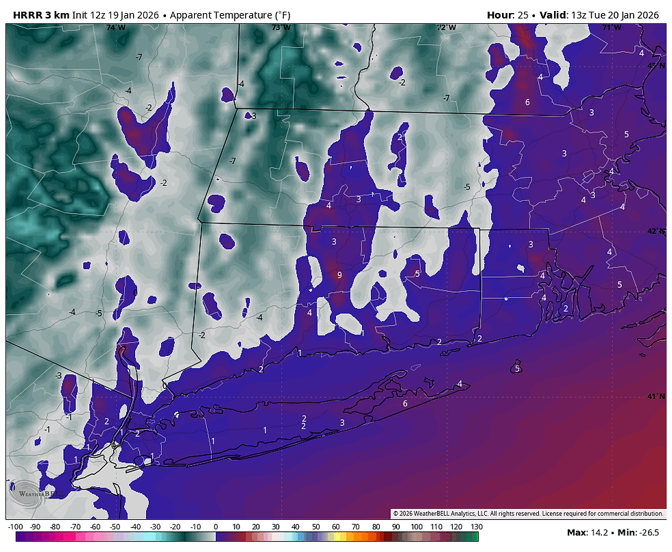
Temperatures this morning are mainly in the single digits for much of the state with low teens along the shoreline. We will only rise into the mid-teens to around 20 during the afternoon & evening when the bulk of the snow is falling. Temperatures will continue to rise during the night as the storm approaches close to our area. Warming in the mid levels of the atmosphere above freezing will cause the snow to mix with or change to sleet, especially along the shore. However, temps at the surface remain in the 20s everywhere in Connecticut overnight. Monday won't be as cold with highs in the upper 20s.
Snowfall Accumulation:
We are looking at around a foot of snow for much of the state with up to 18" in the northwest and northeast hills. Snow mixing with sleet near the shoreline and SE corner will hold accumulations down slightly but most should average around 10" there. Any changeover won't occur until everyone sees at least 8" of snow. Accumulating light snow is possible during the morning and afternoon on Monday. The best chance for this is near the Mass boarder and NE CT. If we tack on another couple inches or so on Monday, some areas may meet or exceed 20". This will be a light and fluffy snow that will be easy to remove. However, a layer of sleet may make this a little more difficult at the shore.


Roads & Travel:
This is an extremely cold snowstorm with frigid temperatures in the single digits and teens. There has been plenty of preparation for this storm, so roads are well treated. However, salt loses it's efficacy when temperatures are around 15 and below. This means any snow that falls this morning and afternoon will stick everywhere, including highways and not melt. As temperatures warm up a bit tonight salt solution will go to work but travel will still be difficult. Connecticut is under a state of emergency as of noon today, so commercial travel will be limited. Only travel if absolutely necessary and use extra caution.
Current Radar:
We will keep you updated to any changes to the forecast throughout the day on social media. If you are interested in checking out all the winter storms we've had so far this season as well as season-to-date snowfall see our Winter 25-26 Page.
-JDJ


Comments