
15 Years Ago: Boxing Day Blizzard
- JDJweather
- Dec 26, 2025
- 2 min read
15 years ago today the Northeast got slammed with a major blizzard known as the "Boxing Day Blizzard of 2010." This nor'easter brought heavy snow and winds during the afternoon of the 26th and continued well into the night before tapering off early on the 27th. Historic snowfall amounts from 15-32" fell over New York and New Jersey.
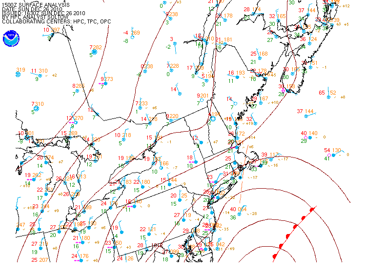
In response to a strong upper level disturbance, low pressure formed off the Delmarva Peninsula and deepened rapidly. It tracked almost due north over Cape Cod and continued north/northeast. Dry air began wrap up and around the system shutting off snow and making it more showery in nature for central Southern New England. However, on the far western and northwestern side of the low, heavy snow set up over New Jersey and the lower Hudson Valley. This band was very narrow in nature but areas under it began to receive snow on the order of 2-4" per hour. Just to the west outside of this band, snowfall rates tapered off dramatically. A second heavy band of snow also parked itself over eastern Massachusetts that left 12-20" of snow.
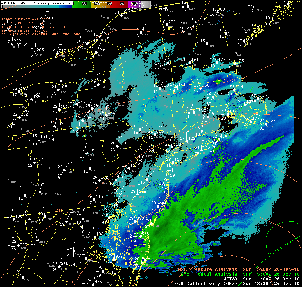
Heavy snow continued overnight and into the early morning hours for New York and New Jersey. Low pressure began pulling away late in the morning the 27th and by early afternoon the storm was completely over. There were two areas of heavy snowfall with this storm, one over eastern MA and RI and the other over far western CT, MA, eastern NJ and Lower Hudson Valley into NYC and Long Island. 20" of snow fell in New York City and 24.2" in Newark making it one of the largest snowstorms on record for these locations.


If you would like to see more images related to this event, check it out in our Winter Storm Archive.
-JDJ


Comments